Posts

Showing posts from August, 2023

BC Wildfires

Image
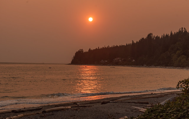
It's Smoky Sun Aug 20th Bonniebrook sunset through a smoky haze  - photo by Martin Davies a local acquaintance A number of friends and family have asked if we have been affected by the wildfires.  The answer is not directly.  Saturday night's sunset was a smoky haze producing a red fiery setting sun.  This morning Vancouver Island is not visible as it is cloaked in smoke. Our immediate neighbours moved here from Kelowna earlier in the year, having sold their house to be closer to their son and his family with whom they now share the house.  Their friends and family back in Kelowna are OK but they "are glad to be living in Gibsons". A small forest fire started up behind us a few weeks ago but was quickly extinguished by local firefighters. According to the BC WIldfire Service there are currently 386 active wildfires of 1865 so far this year.  The map which shows active wildfires is here .  It is changing so quickly, the stats may well have changed by t...

Whistler

Image
The Sea to Sky Highway Wed August 16 Sea to Sky Highway in the 50's I have no idea how many times we have driven the Sea to Sky Highway to get to and from Whistler, and beyond.  The first time was in 2013, when Ros spent a year working for ZipTrek, having transferred from their operation in NZ.   We have seen it when the snow started at the Vancouver end and at times when only when we've got close to Whistler has the snow been evident.  The first half of the drive runs along Howe Sound, until just before Squamish, when the gentle climb starts up to Whistler.  The road has not changed in the ten years we've been driving it, though it is very different to the 50's when the road was on a par with today's Forest Service Roads.   The road we know today was originally started during the early 1900's when copper mining started at the Britannia Mine (1904), just below Squa mish.  There is believed to be an older First Nations trading trail before that....